299 Hanger Road
Opelousas, LA 70570
Phone : (337) 407-1551
After Hours Emergency:
(337) 351-0025
Mondays – Fridays: 8 a.m. – 4:30 p.m.
| FAA Identifier: | OPL |
| Lat/Long: | 30-33-30.2000N 092-05-57.8000W 30-33.503333N 092-05.963333W 30.5583889,-92.0993889 (estimated) |
| Elevation: | 74.7 ft. / 22.8 m (surveyed) |
| Variation: | 01E (2010) |
| From city: | 2 miles NW of OPELOUSAS, LA |
| Time zone: | UTC -6 (UTC -5 during Daylight Saving Time) |
| Zip code: | 70570 |
| Airport use: | Open to the public |
| Activation date: | 10/1947 |
| Control tower: | no |
| ARTCC: | HOUSTON CENTER |
| FSS: | DE RIDDER FLIGHT SERVICE STATION |
| NOTAMs facility: | OPL (NOTAM-D service available) |
| Attendance: | MON-FRI 0800-1700, ALL SAT 0800-1200 |
| Wind indicator: | lighted |
| Segmented circle: | yes |
| Lights: | MIRL RY 18/36, REIL RYS 18 & 36 PRESET LOW INTST DUSK-DAWN; TO INCR INTST ACTVT – CTAF. |
| Beacon: | white-green (lighted land airport) Operates sunset to sunrise. |
| Fuel available: | 100LL JET-A+ FUEL AVBL 24 HRS WITH CREDIT CARD. |
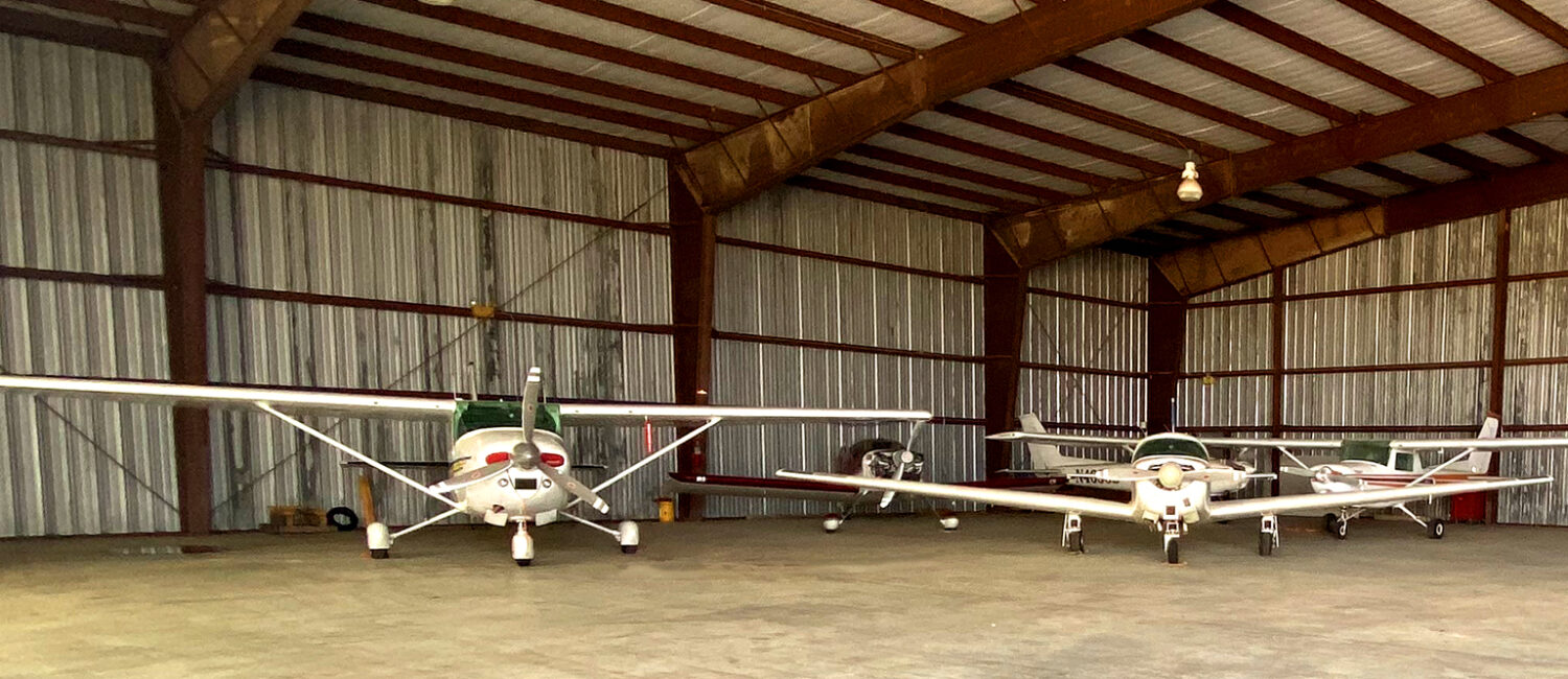
| Parking: | hangars and tiedowns |
| Airframe service: | MINOR |
| Powerplant service: | MINOR |
| CTAF/UNICOM: | 123.0 |
| WX AWOS-3PT: | 118.775 (337-948-8560) |
| LAFAYETTE APPROACH: | 128.7 |
| LAFAYETTE DEPARTURE: | 128.7 |
| VOR radial/distance | VOR name | Freq | Var | |||
|---|---|---|---|---|---|---|
| LFTr343/22.6 | LAFAYETTE VORTAC | 109.80 | 03E |
| NDB name | Hdg/Dist | Freq | Var | ID | |||||
|---|---|---|---|---|---|---|---|---|---|
| DURALDE | 088/18.0 | 263 | 02E | ECY | . -.-. -.– | ||||
| ABBEVILLE | 000/29.9 | 230 | 02E | BNZ | -… -. –.. | ||||
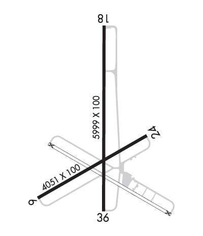
| Dimensions: | 5999 x 100 ft. / 1828 x 30 m | ||||
| Surface: | concrete, in good condition | ||||
| Weight bearing capacity: |
| ||||
| Runway edge lights: | medium intensity | ||||
| RUNWAY 18 | RUNWAY 36 | ||||
| Latitude: | 30-34.102533N | 30-33.112928N | |||
| Longitude: | 092-05.932275W | 092-05.935547W | |||
| Elevation: | 71.1 ft. | 71.4 ft. | |||
| Traffic pattern: | right | left | |||
| Runway heading: | 179 magnetic, 180 true | 359 magnetic, 000 true | |||
| Displaced threshold: | 150 ft. | 789 ft. | |||
| Markings: | nonprecision, in good condition | nonprecision, in good condition | |||
| Visual slope indicator: | 2-light PAPI on left (3.50 degrees glide path) | 2-light PAPI on left (3.50 degrees glide path) | |||
| Runway end identifier lights: | yes | yes | |||
| Touchdown point: | yes, no lights | yes, no lights | |||
| Obstructions: | 48 ft. tree, 943 ft. from runway, 114 ft. left of centerline, 15:1 slope to clear APCH SLOPE 16:1 TO DSPLCD THLD. | 19 ft. road, 307 ft. from runway, 5:1 slope to clear APCH SLOPE 30:1 TO DSPLCD THLD. | |||
| Dimensions: | 4051 x 100 ft. / 1235 x 30 m | ||||
| Surface: | concrete, in fair condition RY HAS SOME CRACKS WITH GRASS GROWING THRU CRACKS. | ||||
| Weight bearing capacity: |
| ||||
| Runway edge markings: | RY MARKINGS ARE FADED. | ||||
| RUNWAY 6 | RUNWAY 24 | ||||
| Latitude: | 30-33.184145N | 30-33.516652N | |||
| Longitude: | 092-06.339817W | 092-05.669980W | |||
| Elevation: | 70.0 ft. | 74.7 ft. | |||
| Traffic pattern: | left | right | |||
| Runway heading: | 059 magnetic, 060 true | 239 magnetic, 240 true | |||
| Displaced threshold: | 165 ft. | 169 ft. | |||
| Markings: | basic, in poor condition | basic, in poor condition | |||
| Touchdown point: | yes, no lights | yes, no lights | |||
| Obstructions: | 45 ft. trees, 688 ft. from runway, 107 ft. left of centerline, 10:1 slope to clear APCH RATIO 10:1 FM DSPLCD THLD. | 60 ft. trees, 397 ft. from runway, 72 ft. right of centerline, 3:1 slope to clear APCH RATIO 19:1 FM DSPLCD THLD. | |||

Monday through Friday
8:00 a.m. to 4:30 p.m.
Call for an appointment during the COVID-19 pandemic.